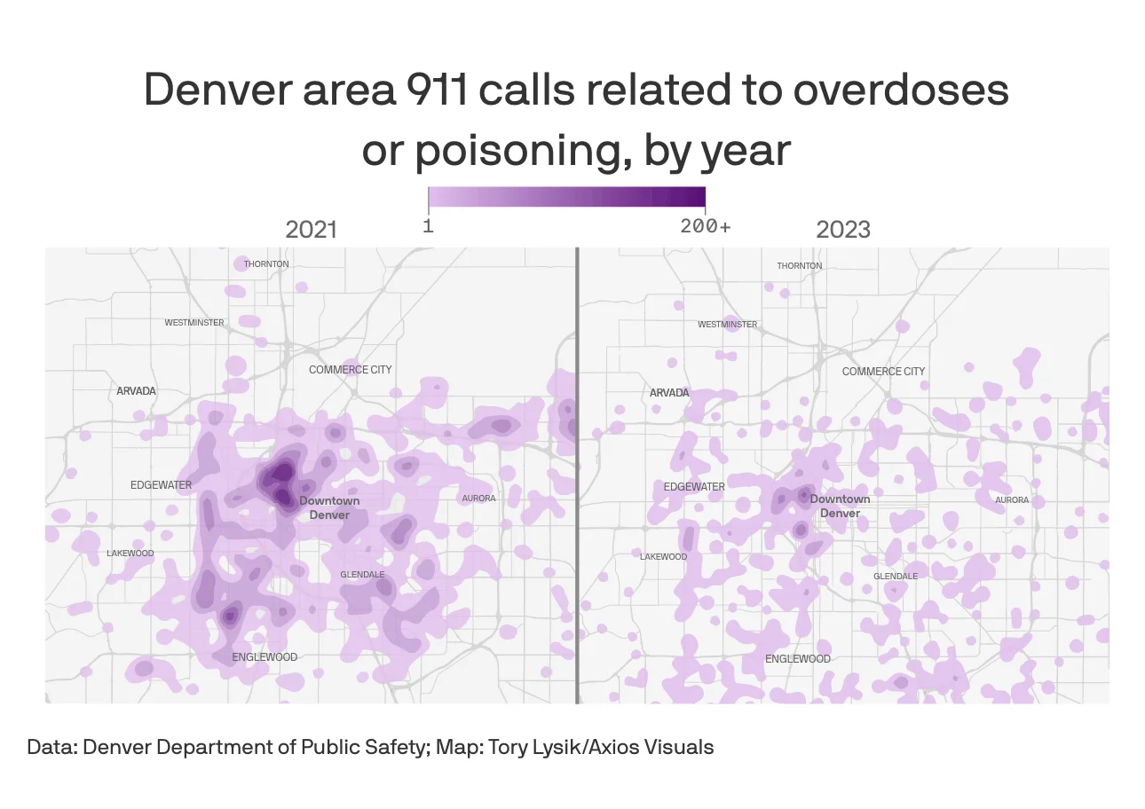
In Denver a controversial bill caused overdose deaths to rise while emergency calls fell
Used R for statistical analysis and geospatial mapping to visualize neighborhood-level overdose patterns across Denver, revealing a 27% drop in emergency calls while deaths climbed. State lawmakers cited our findings in proposed amendments to the legislation. Data was gathered via FOIA requests, and maps were created using GIS and ArcGIS.
Awards
Colorado Press Association: Best Infographics & Best Newsletter of 2024
Collaborators
Esteban Hernandez